Graduate student Lexie DelViscio joined our lab from the College of Charleston in Sept 2024, having completed the BEAMS program (BEnthic Acoustic Mapping and Survey) as part of her undergraduate program. BEAMS has a mission to develop a cohort of professional ocean surveyors, and Lexie’s skills and interests were a great fit for our lab in furthering our work into seafloor topography and its impact on benthic communities.
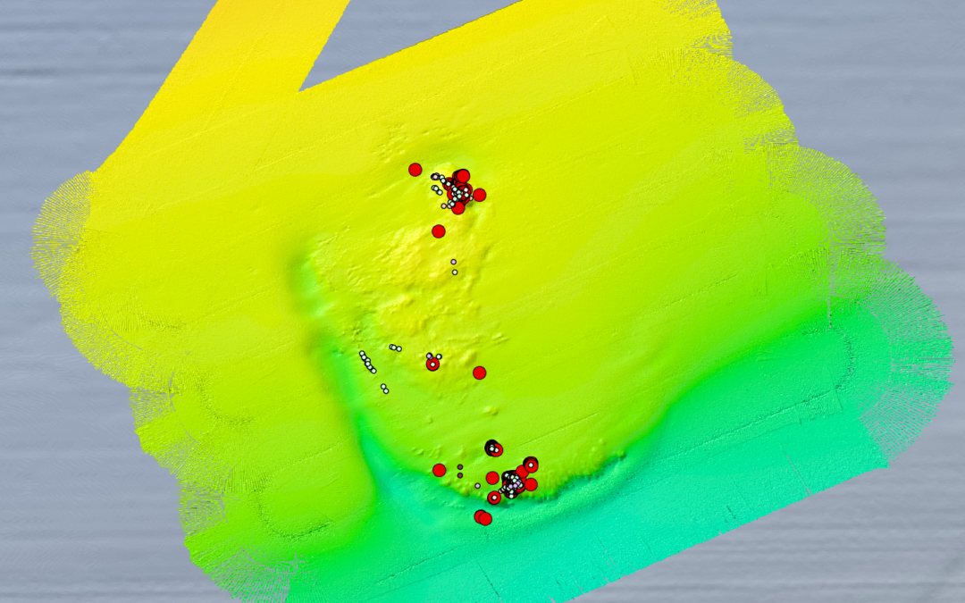
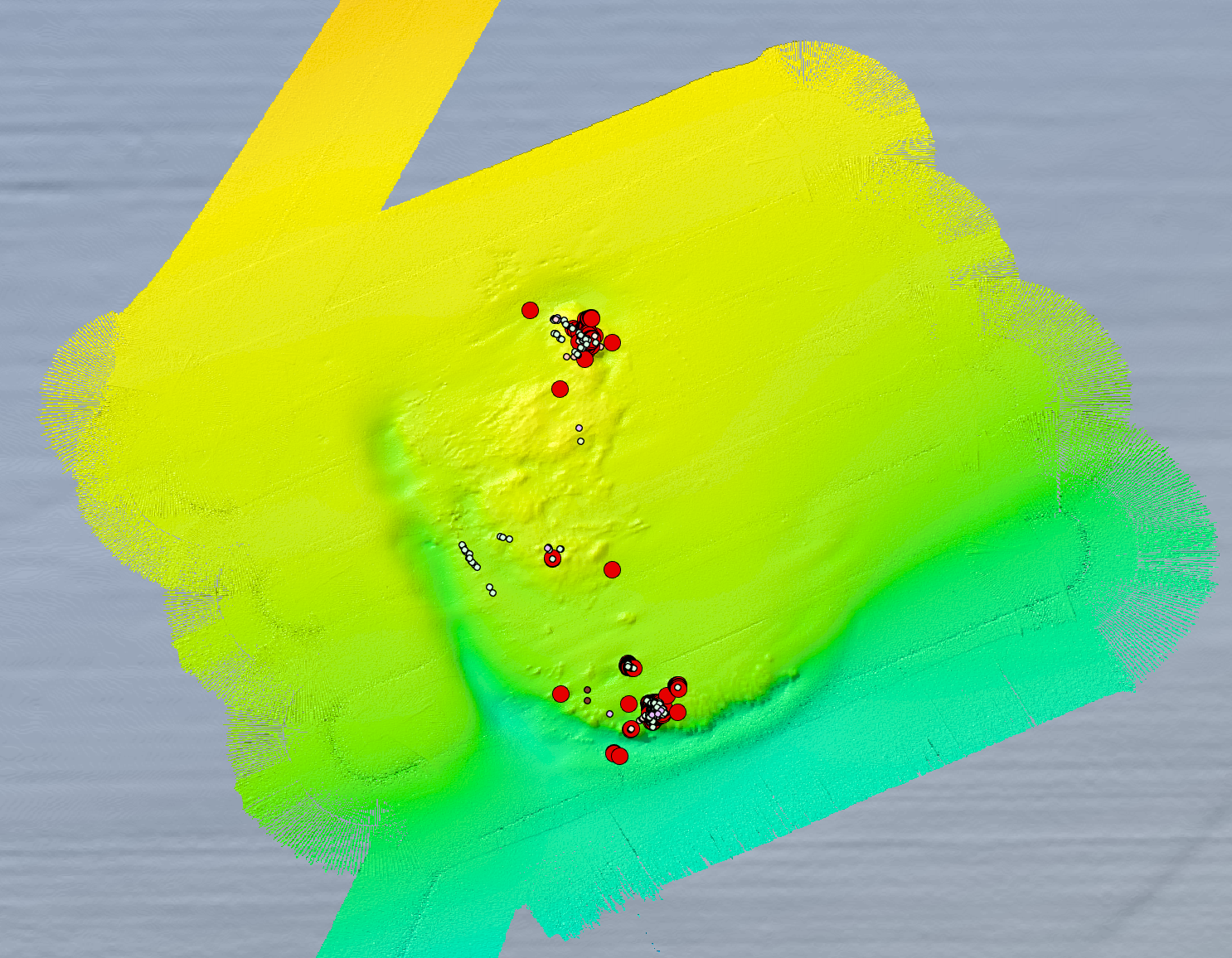
Recently, Lexie looked into some freely available multibeam data from NOAA’s NCEI dataset to explore the topography of a deep-coral reef site in the Gulf Coast. Known as Viosca Knoll, this area is home to some of the most vibrant Desmophyllum pertusum communities in the region. Several studies have been conducted in the region, including work from our collaborators Erik Cordes and Alexis Weinnig. In particular, we were interested in looking at a well known site called VK 906, which is a site not farm from VK 826 where we’ve worked in the past.
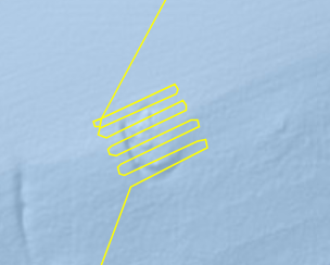
In this exercise, Lexie analyzed a series of lines from the NOAA ship Okeanos Explorer that were collected on the mission EX105, way back in 2011.
Lexie utilized the QPS Qimera software to undertake the analysis. First,
Lexie’s processing steps were as follows:
- Lexie imported all raw multibeam trackline data to Qimera from the NCEI database. Selecting tracklines specifically around the site VK 906, and kept only these lines in the project. This ended up being 17 of >100 files, which without subsetting was over 30GB in size.
- Then, Lexie SVP corrected the data using the “Processing Settings Editor” in Qimera,and used the settings “Nearest in Time” and “Use SVP Crossfade at 60 seconds”.
- Lexie then selected all of the tracklines and created a dynamic grid surface, one with CUBE hypothesis and one without. The CUBE hypothesis surface used the method of “Num. Samples + Neighborhood” and was gridded to a cell size of 10 m.
- Lexie then cleaned any egregious spikes and pockmarks as well as track line artifacts using the “Slice Editor” tool and removed poor quality soundings.
- After cleaning, Lexie created a Static Surface of the area to be exported to ArcGIS for visualization. The static surface was also gridded using a cell size of 10 m and used gridding type “Weighted Moving Average” with a weighting diameter of 1 cell.
The final amazing results are below.
Qimera was provided by QPS.